'DMZ Peace Road,' where visitors can see the ecological, cultural, and historical resources of the border areas of the Demilitarized Zone and experience the preciousness of peace firsthand. [Photo by Reporter Lim Yo-hee]
'DMZ Peace Road' was opened to the public in 2018, 65 years after the Armistice Agreement. The Demilitarized Zone (DMZ) is the world's only divided territory, a treasure trove of natural ecosystems, and a place where the risk of military conflict between the South and North has always existed.
However, in 2018, through an agreement between the South and North, it was decided to transform the DMZ into a practical zone of peace and it was opened to the public. Peace Road allows visitors to see the ecological, cultural, and historical resources of the DMZ border areas and experience the preciousness of peace firsthand, even earning the title of 'Top 1 Korean Travel Destination Foreigners Want to Visit.' The Korean Peninsula DMZ is the only legacy of the Cold War in the world that has been maintained for over 60 years.
#1 Korean Travel Destination Foreigners Want to Visit
Among the 10 border areas of Ganghwa, Gimpo, Goyang, Paju, Yeoncheon, Cheorwon, Hwacheon, Yanggu, Inje, and Goseong, the Goseong course, which belongs to the eastern front, allows access to the Southern Limit Line.
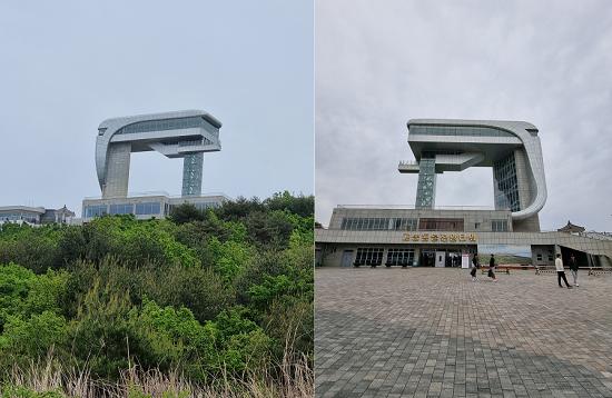 The rear (left) and front of the Unification Observatory. 'DMZ Peace Road' visitors are granted the privilege of seeing the rear. [Photo by Reporter Lim Yo-hee]Until now, the northernmost point accessible to civilians was the Goseong Unification Observatory. However, now it is possible to walk along the coast to the very edge of the DMZ through the exit of 'DMZ Peace Road.' This allows access 1612m further than the Goseong Unification Observatory.
The course proceeds from Goseong Unification Observatory → Coastal Observatory → Tongjeon Tunnel → Southern Limit Line, and is designed to allow visitors to experience the beauty of the East Sea and the reality of division simultaneously.
Peace Road, true to its name, is not an easy journey from the start. After completing the entry report at the Unification Security Center, visitors must undergo a military verification process at the Jejin Checkpoint to be allowed entry to the Goseong Unification Observatory. Completing all these steps takes a considerable amount of time, so it's advisable to set out with ample time. As 20 scheduled visitors gather and depart simultaneously, missing the assembly time (10 AM, 2 PM departures) means immediate disqualification.
Photography is strictly prohibited within the DMZ, but it is exceptionally allowed at the Coastal Observatory at the entrance. Visitors take advantage of this exception to take many photos with the blue sea as their background, thinking, "When will we ever get to come here again?"
Two soldiers and two guides accompany the Peace Road trek. The guides strictly warn visitors not to touch the barbed wire fences. In the past, soldiers stood guard 24 hours a day, but nowadays, sensors perform this duty. Touching the fences will immediately dispatch military forces, causing the tour to be suspended.
A Road Exists, But We Cannot Travel It! The East Coast Northern Railway Line, Geumgangsan Road
After passing the Coastal Observatory, you will encounter the East Coast Northern Railway Line, which passes through the Tongjeon Tunnel. The East Coast Northern Railway Line is a railway connecting Yangyang to Wonsan over a distance of 192 km. Damaged during the Korean War, it was restored and test-operated for 25.5 km from Jejin Station to Geumgangsan Youth Station in North Korea in 2007 through inter-Korean agreement.
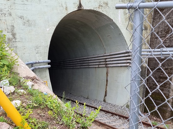 After passing the Coastal Observatory, you will find the Tongjin Tunnel through which the East Coast Northern Railway Line passes. [Photo by Reporter Lim Yo-hee]
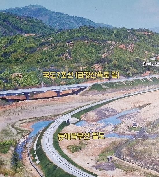 [Ministry of National Defense file photo]
The restoration project of the East Coast Northern Railway Line brought great hope of being able to travel by train not only across the Korean Peninsula but also to Europe. However, as inter-Korean relations rapidly cooled down the following year, the project was abandoned.
Next to the railway, the 'Geumgangsan Road,' an extension of National Route 7, runs parallel. It is hard to believe that at one time, as many as 2 million tourists traveled this road to visit Geumgangsan, yet the road is now quiet and desolate.
The waves crash unconcernedly, but what is it that seems to be overwhelming? The Korean roses, lying low on the ground, cautiously reveal their red blossoms. Visitors walk in an orderly fashion across Songhyeon 1 and Songhyeon 2 bridges, the northernmost bridges in South Korea. Beneath the bridges, heavy iron gates are lowered to prevent the entry of tanks. These gates are opened only during heavy rains to prepare for floods.
Imagining the Northern Limit Line in Our Hearts
The Peace Road tour concludes at the 'Southern Limit Line,' 1612m further than the Unification Observatory. Although one wishes to reach at least 'Songdo Observatory' just ahead, it is not possible. The Haegumgang Peninsula jutting into the East Sea, the horse-shaped peninsula, and the scattered islands on the sea appear within reach, but they are unreachable.
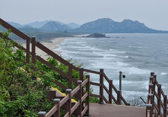 Coastal Observatory. [Photo by Reporter Lim Yo-hee]
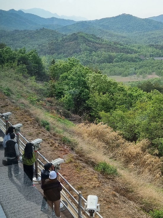 On a clear day, standing at the Goseong Unification Observatory, you can see the foothills of Geumgangsan Mountain with the naked eye. On the far left of the photo is the Goseong GP. Following the slope next to it, there is a North Korean guard post where the terrain once rose. Behind it, the faintly visible mountain range is Geumgangsan Mountain. From left to right: Ilchulbong, Chaehwabong, Yukseonbong, Jipseonbong, Sejonbong, Okryeobong, Shinseondae... [Photo by Reporter Lim Yo-hee]
The Northern Limit Line, said to be at the foot of Guseonbong (Camel Peak), the easternmost peak of Geumgangsan, and the lake 'Gamho,' imbued with the legend of the fairy and the woodcutter below it, can only be imagined.
The Goseong course has a capacity of 20 people per session. It operates five days a week (Tuesday, Wednesday, Friday, Saturday, Sunday) twice a day (10 AM, 2 PM). The participation fee is 10,000 won, but since souvenirs are given after the tour, the fee is largely symbolic. It operates from April 17th to the end of November, excluding the peak summer and winter seasons.
After completing the Goseong course, you can also try the nearby Geumgangsan Observatory course. It starts from the Goseong Unification Observatory, the same as the Goseong course, but by car, visitors travel beyond the Southern Limit Line to the Geumgangsan Observatory. While the Goseong course, which involves a lot of walking, is for ages 7 and up, the Geumgangsan Observatory course has no age restrictions as it uses vehicles.
▲ Do we really not arm ourselves in the DMZ?
The Demilitarized Zone on the Korean Peninsula, according to the Armistice Agreement of 1953, refers to a buffer zone with a width of 4 km, 2 km each to the north and south of the Military Demarcation Line (MDL). However, in reality, it is the most heavily armed zone, where opposing forces stand in confrontation while armed.
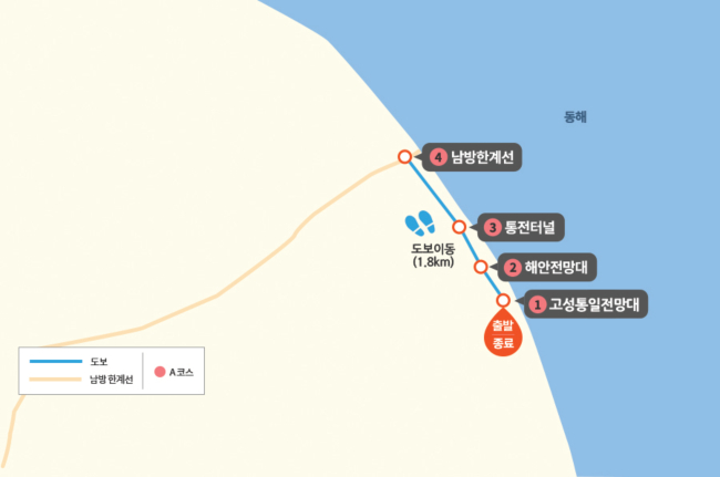
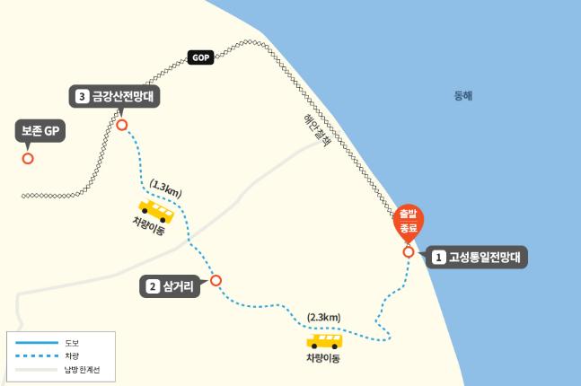 The Goseong Course (top) and Geumgangsan Course of 'DMZ Peace Road.'
Reporter Lim Yo-hee

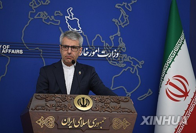 Iranian Foreign Ministry: "Continuing Message Exchanges with the U.S. and Activities of Mediating Countries"
Esmaeil Baghaei, Spokesperson for the Iranian Ministry of Foreign Affairs [Xinhua, Yonhap News file photo]Esmaeil Baghaei, spokesperson for the Iranian Ministry of Foreign Affairs, stated on the 26th
Iranian Foreign Ministry: "Continuing Message Exchanges with the U.S. and Activities of Mediating Countries"
Esmaeil Baghaei, Spokesperson for the Iranian Ministry of Foreign Affairs [Xinhua, Yonhap News file photo]Esmaeil Baghaei, spokesperson for the Iranian Ministry of Foreign Affairs, stated on the 26th
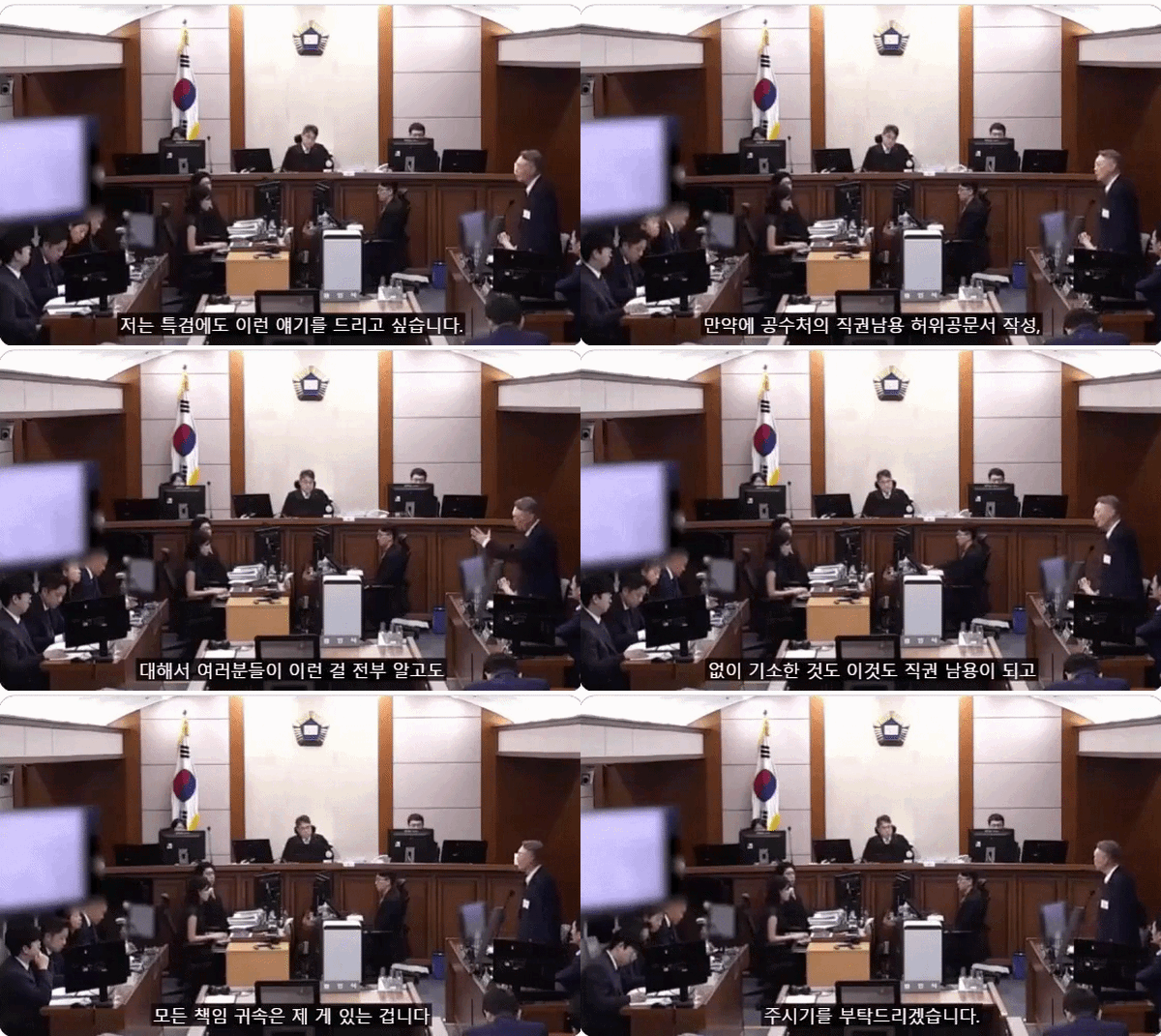 President Yoon: "Do You Think You Are Safe from the Special Counsel?"... Final Statement Video Released
President Yoon Suk Yeol rebuking the special prosecutor on the 24th. [Court video / @birds_justice X account subtitle GIF] A video of President Yoon Suk Yeol's closing statement at his trial rega
President Yoon: "Do You Think You Are Safe from the Special Counsel?"... Final Statement Video Released
President Yoon Suk Yeol rebuking the special prosecutor on the 24th. [Court video / @birds_justice X account subtitle GIF] A video of President Yoon Suk Yeol's closing statement at his trial rega
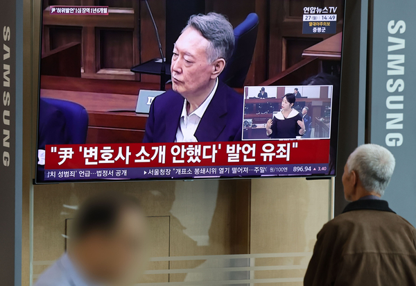 President Yoon, regarding the first-instance ruling on the Public Official Election Act: “An excessive political verdict that distorts the facts… We will appeal immediately.”
The first-instance sentencing hearing for President Yoon Suk Yeol regarding violations of the Public Official Election Act is being broadcast live at Seoul Station on the 27th. [Photo=Yonhap News]Pres
President Yoon, regarding the first-instance ruling on the Public Official Election Act: “An excessive political verdict that distorts the facts… We will appeal immediately.”
The first-instance sentencing hearing for President Yoon Suk Yeol regarding violations of the Public Official Election Act is being broadcast live at Seoul Station on the 27th. [Photo=Yonhap News]Pres
 WSJ: "SK Hynix ADR Premium Is a Sign of AI Trading Overheat"
Advertisement for SK Hynix ADR listing in New York's Times Square [Reuters=Yonhap News file photo]The Wall Street Journal (WSJ) has pointed out that the price of SK Hynix’s American Depositary Recei
WSJ: "SK Hynix ADR Premium Is a Sign of AI Trading Overheat"
Advertisement for SK Hynix ADR listing in New York's Times Square [Reuters=Yonhap News file photo]The Wall Street Journal (WSJ) has pointed out that the price of SK Hynix’s American Depositary Recei
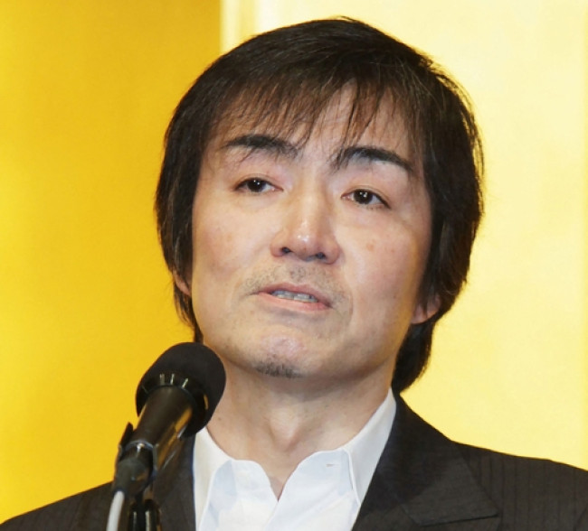 'Godfather of Japanese Mystery Novels' Keigo Higashino Passes Away After Battle with Cancer at 68
Famous Japanese mystery novelist Keigo Higashino [AFP=Yonhap News]It has been belatedly reported that Keigo Higashino, the "godfather of Japanese mystery novels" and author of bestsellers such as "The
'Godfather of Japanese Mystery Novels' Keigo Higashino Passes Away After Battle with Cancer at 68
Famous Japanese mystery novelist Keigo Higashino [AFP=Yonhap News]It has been belatedly reported that Keigo Higashino, the "godfather of Japanese mystery novels" and author of bestsellers such as "The
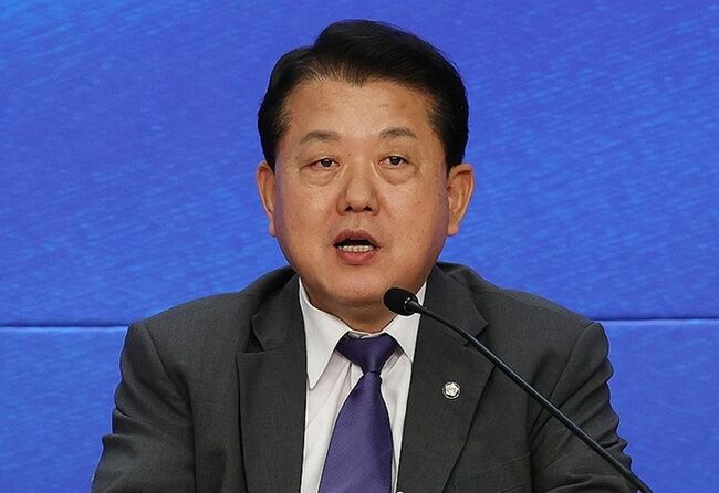 [Park Pil-kyu Security Column] To the Ignorant Trying to Clothe a Beast in Sheep's Clothing
Rep. Kim Byung-joo of the Democratic Party of Korea [Photo=Yonhap News]“The Air Force Academy doesn't teach you how to fly a plane!” “The Army, Navy, and Air Force academies are exactly the
[Park Pil-kyu Security Column] To the Ignorant Trying to Clothe a Beast in Sheep's Clothing
Rep. Kim Byung-joo of the Democratic Party of Korea [Photo=Yonhap News]“The Air Force Academy doesn't teach you how to fly a plane!” “The Army, Navy, and Air Force academies are exactly the
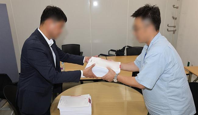 [Issue Diagnosis] Two Effects of the Election Petition Review
 [Photo] Evidence of Election Fraud Flooding U.S. Media… Trump Had 2.7 Million Votes Stolen
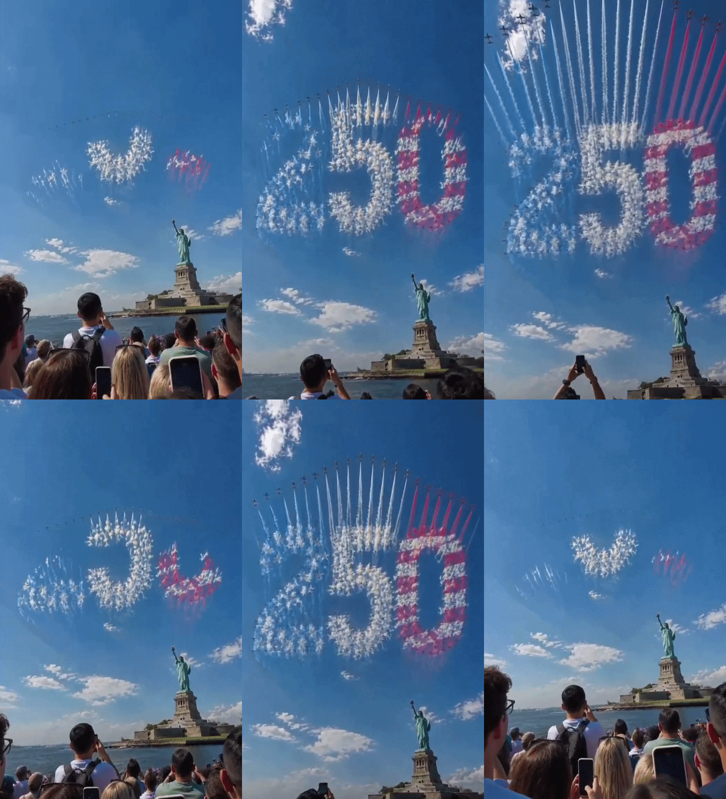 [Video] U.S. Semiquincentennial Air Show... 'Art in the Sky' streaks across New York
 [Editorial Cartoon] A Draconian Law That Undermines Freedom of Expression

 List
List