Rain in the Central Region including the Seoul Metropolitan Area until afternoon… Light rain also on the East Coast thanks to Typhoon Faxai
Over 40mm already in Seoul… Showers of up to 60mm concentrated in the southern regions and Jeju Island
Daytime temperatures between 25-33 degrees Celsius… Not excessively hot in the central region, but the apparent temperature in the southern region will be around 33 degrees Celsius
 Rain is falling in Gangneung, Gangwon Province on the afternoon of the 1st. [Yonhap News photo archive]
Rain is expected to fall mainly in the central regions on the 4th.
Thanks to Typhoon Faxai, the 15th typhoon, which will pass through southern Japan, the East Coast will also receive 'enough to quench your thirst' light rain.
However, the northern East Coast will receive more rainfall than the central and southern East Coast areas of Gangwon Province, which are suffering from severe drought.
The rain began to fall from the western coast of the central region in the early hours of the morning, and as of 8 AM, rain is falling in the Seoul Metropolitan Area, the East Coast, Gangwon Province, northern Chungnam Province, and the northeastern East Coast of Gyeongbuk Province.
From the start of the day until 8 AM, Seoul (based on the Seoul Meteorological Observatory in Songwol-dong, Jongno-gu) received 41.8 mm of rain, and Incheon (based on the Incheon Meteorological Station in Jeon-dong, Jung-gu) received 33.9 mm.
In Gangbuk-gu, Seoul, 50 mm of heavy rain fell in one hour from 3:06 AM, and a total of 72.5 mm has fallen so far.
A considerable amount of rain has poured down in northern Gyeonggi Province, with 97.0 mm in Yangju-si (Nambang-dong) and 82.0 mm in Uijeongbu (Singok-dong).
The Seoul Metropolitan Area and northern Chungnam Province will experience rain until the afternoon, while Gangwon Province and the northeastern East Coast and mountainous areas of Gyeongbuk Province will have intermittent rain throughout the day.
The expected precipitation is 10-60 mm for the Seoul Metropolitan Area and the Western Sea Islands, 5-60 mm for the northwestern coast of Chungnam Province, 5-40 mm for the inland and mountainous areas of Gangwon Province, 5-20 mm for the northeastern East Coast of Gangwon Province, Sejong, inland northern Chungnam Province, southwestern coast of southern Chungnam Province, the East Coast of Gyeongbuk Province, and the northeastern mountainous areas of Gyeongbuk Province, around 5 mm for Ulleungdo and Dokdo, and less than 5 mm for the central and southern East Coast of Gangwon Province.
This rain is occurring because a trough in the upper atmosphere over the northern part of the Korean Peninsula causes cold and dry air descending from the north to settle, forming high-pressure systems over the Shandong Peninsula of China and the northern East Sea. A low-pressure trough formed between these two high-pressure systems is moving across Korea, carried by the westerly winds.
As the low-pressure trough moves eastward over the East Sea, the rain is expected to stop in most areas by the afternoon.
However, the East Coast will experience more rain due to Typhoon Faxai, which developed southeast of Kagoshima, Japan, and is moving northward. As it enters the westerly wind belt in the afternoon, its path will shift eastward, causing more rain.
Faxai and the high-pressure system in the northern East Sea will create a 'high in the north, low in the south' pressure system over the East Sea, causing strong easterly winds to blow towards Korea. These easterly winds will ascend the Taebaek Mountains, bringing rain.
In the Northern Hemisphere, winds blow clockwise along the edges of high-pressure systems and counterclockwise around low-pressure centers. In a 'high in the north, low in the south' pressure system, easterly winds blow inwards.
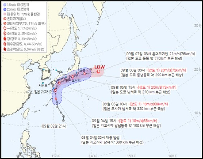 Estimated path of Typhoon Faxai, the 15th typhoon, announced by the Korea Meteorological Administration at 4:30 AM on the 4th. [Provided by the Korea Meteorological Administration. Reproduction and database prohibited]
Faxai will also bring showers to southern Chungnam Province, Chungbuk Province, the southern regions (excluding the East Coast of Gyeongbuk Province), and Jeju Island.
Showers are expected to occur in the southern regions and Jeju Island as Faxai injects hot and humid air, and as temperatures rise due to solar radiation, creating unstable atmospheric conditions.
The expected rainfall from the showers is 5-60 mm for Jeonnam and other regions, and 5-40 mm (over 60 mm in Jeju) for other areas.
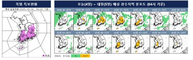
Daytime temperatures are expected to be between 25 and 33 degrees Celsius.
Daytime highs will reach 29 degrees Celsius in Seoul, Incheon, and Ulsan, 30 degrees in Daejeon, 31 degrees in Daegu and Busan, and 32 degrees in Gwangju.
The central regions will not be excessively hot due to the rain, but the apparent temperature in the southern regions will reach around 33 degrees Celsius, making it muggy.
Strong winds with instantaneous speeds of 55 km/h (15 m/s) are expected on the coast of Gyeongnam Province and the southeastern East Coast of Gyeongbuk Province until the afternoon of the 5th, so caution is advised.
Strong winds with instantaneous speeds of 55 km/h will blow across all sea areas.

 Trump pressures for rate cut again ahead of FOMC... "Should be the lowest in the world"
U.S. President Donald Trump. [Photo = The White House] U.S. President Donald Trump once again pressured the Federal Reserve, the U.S. central bank, to lower interest rates on the 27th (local time
Trump pressures for rate cut again ahead of FOMC... "Should be the lowest in the world"
U.S. President Donald Trump. [Photo = The White House] U.S. President Donald Trump once again pressured the Federal Reserve, the U.S. central bank, to lower interest rates on the 27th (local time
 “Ignoring crisp ballots and damaged seals”… Tongyeong mayoral recount concludes with ‘no change in outcome,’ leaving suspicions and public outrage behind
Suspected counterfeit ballots discovered in Tongyeong [GIF from social media of Representative Hwang Kyo-ahn / Attorney Park Joo-hyun]During a recount of the Tongyeong mayoral election in South Gyeong
“Ignoring crisp ballots and damaged seals”… Tongyeong mayoral recount concludes with ‘no change in outcome,’ leaving suspicions and public outrage behind
Suspected counterfeit ballots discovered in Tongyeong [GIF from social media of Representative Hwang Kyo-ahn / Attorney Park Joo-hyun]During a recount of the Tongyeong mayoral election in South Gyeong
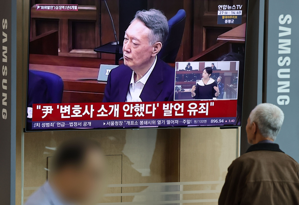 President Yoon, regarding the first-instance ruling on the Public Official Election Act: “An excessive political verdict that distorts the facts… We will appeal immediately.”
The first-instance sentencing hearing for President Yoon Suk Yeol regarding violations of the Public Official Election Act is being broadcast live at Seoul Station on the 27th. [Photo=Yonhap News]Pres
President Yoon, regarding the first-instance ruling on the Public Official Election Act: “An excessive political verdict that distorts the facts… We will appeal immediately.”
The first-instance sentencing hearing for President Yoon Suk Yeol regarding violations of the Public Official Election Act is being broadcast live at Seoul Station on the 27th. [Photo=Yonhap News]Pres
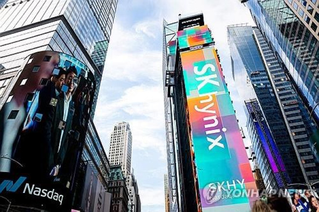 WSJ: "SK Hynix ADR Premium Is a Sign of AI Trading Overheat"
Advertisement for SK Hynix ADR listing in New York's Times Square [Reuters=Yonhap News file photo]The Wall Street Journal (WSJ) has pointed out that the price of SK Hynix’s American Depositary Recei
WSJ: "SK Hynix ADR Premium Is a Sign of AI Trading Overheat"
Advertisement for SK Hynix ADR listing in New York's Times Square [Reuters=Yonhap News file photo]The Wall Street Journal (WSJ) has pointed out that the price of SK Hynix’s American Depositary Recei
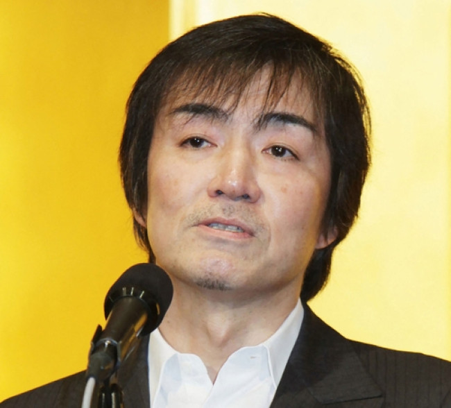 'Godfather of Japanese Mystery Novels' Keigo Higashino Passes Away After Battle with Cancer at 68
Famous Japanese mystery novelist Keigo Higashino [AFP=Yonhap News]It has been belatedly reported that Keigo Higashino, the "godfather of Japanese mystery novels" and author of bestsellers such as "The
'Godfather of Japanese Mystery Novels' Keigo Higashino Passes Away After Battle with Cancer at 68
Famous Japanese mystery novelist Keigo Higashino [AFP=Yonhap News]It has been belatedly reported that Keigo Higashino, the "godfather of Japanese mystery novels" and author of bestsellers such as "The
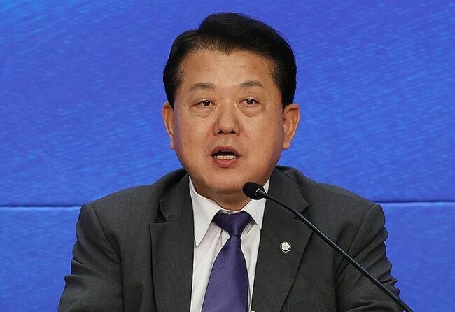 [Park Pil-kyu Security Column] To the Ignorant Trying to Clothe a Beast in Sheep's Clothing
Rep. Kim Byung-joo of the Democratic Party of Korea [Photo=Yonhap News]“The Air Force Academy doesn't teach you how to fly a plane!” “The Army, Navy, and Air Force academies are exactly the
[Park Pil-kyu Security Column] To the Ignorant Trying to Clothe a Beast in Sheep's Clothing
Rep. Kim Byung-joo of the Democratic Party of Korea [Photo=Yonhap News]“The Air Force Academy doesn't teach you how to fly a plane!” “The Army, Navy, and Air Force academies are exactly the
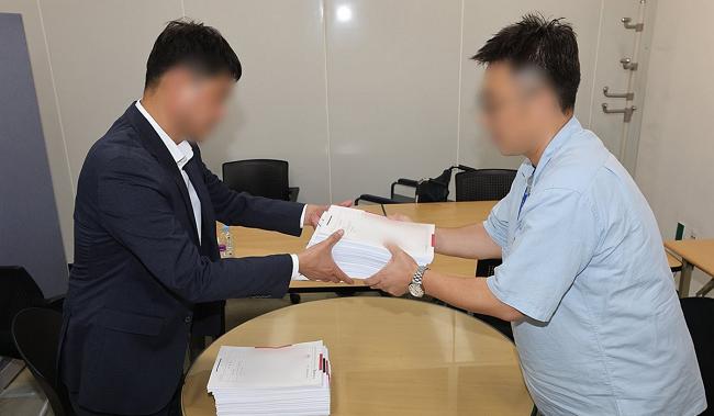 [Issue Diagnosis] Two Effects of the Election Petition Review
 [Photo] Evidence of Election Fraud Flooding U.S. Media… Trump Had 2.7 Million Votes Stolen
 [Video] U.S. Semiquincentennial Air Show... 'Art in the Sky' streaks across New York
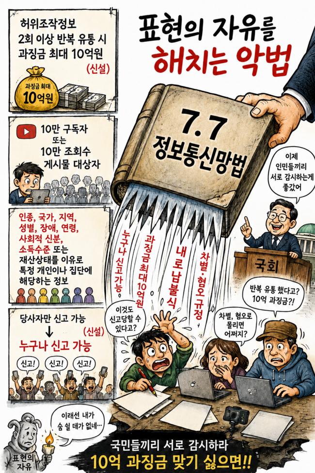 [Editorial Cartoon] A Draconian Law That Undermines Freedom of Expression

 List
List