On the afternoon of the 17th, a merchant in Okpo-dong, Geoje, South Gyeongsang Province, gestures to show that floodwaters reached more than a meter high, halfway up the curtains. [Yonhap News]The primary reason for the "record-breaking" rainfall along the southern coast of South Gyeongsang Province, including Geoje, during the Liberation Day holiday was a high-pressure system to the northeast of the Korean Peninsula that blocked the movement of a low-pressure system.
The Korea Meteorological Administration (KMA) identified the delayed movement of the low-pressure system, caused by the strengthening of the eastern high-pressure system, as the primary factor. It also analyzed that topographical features, the development of the low-pressure system, and the inflow of a large volume of water vapor contributed to the event.
According to the KMA's analysis on the 18th, as a low-pressure system—which had weakened from the 13th Typhoon Dolphin—approached from the southwest while a high-pressure system remained to the southeast, a powerful stream of hot, humid air with a precipitable water vapor level reaching 70mm was funneled into the Korean Peninsula from the south during the holiday.
In the Northern Hemisphere, winds circulate counterclockwise around a low-pressure system and clockwise along the edges of a high-pressure system. Consequently, when a low-pressure system is positioned to the west of the Korean Peninsula and a high-pressure system to the east, it creates strong southerly winds.
Precipitable water refers to the total amount of water vapor in an atmospheric column if it were to all condense into liquid.
These southerly winds, laden with heavy moisture, formed intense rain clouds upon reaching the southern coast.
When airflow traveling over the ocean encounters land, friction with the ground causes its speed to drop sharply and its direction to shift. This causes air to accumulate in the lower levels of the coastal atmosphere, and as this accumulated air rises, it creates rain cloud formations.
It was also analyzed that the mountain ranges in Geoje, with altitudes around 500 meters, partially contributed to the convergence of airflow by reducing wind speeds.
The KMA explained, "In this instance, a low-pressure system developed through the combination of upper and lower atmospheric layers. While a trough in the upper atmosphere approached slowly from the northwest, it had a significant impact, and in the lower atmosphere, the intense inflow of southerly winds led to strong convergence along the southern coast."
They added, "The coastline and topography of Geoje were favorable for the development of a meso-scale low-pressure system, and winds conducive to such development continued to blow."
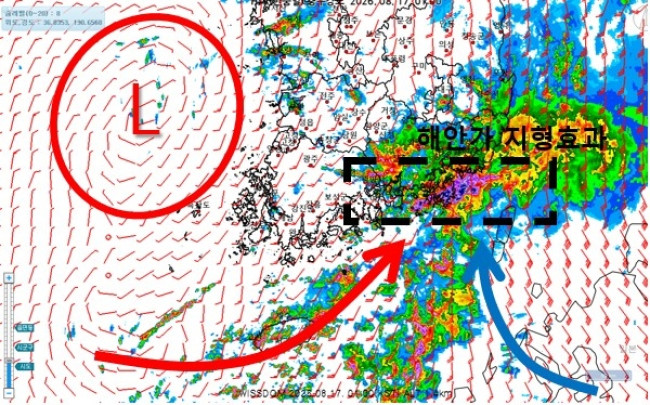 Schematic of low-pressure development during the Geoje heavy rainfall. [Provided by KMA]
The high-pressure zone to the northeast of Korea remained firmly in place, obstructing the movement of the low-pressure system and increasing the pressure gradient force, which intensified the southerly winds in the lower atmosphere. The low-pressure system, which had weakened from Typhoon Nangka (the 17th typhoon) south of Japan, further assisted the expansion of the high-pressure zone to the southwest.
The pressure gradient force is the force caused by the difference in atmospheric pressure, acting from areas of high pressure to areas of low pressure. The closer the distance between two points with a pressure difference, the stronger the pressure gradient force.
In this case, as the low-pressure system moved east while the high-pressure system held its position, the distance between them narrowed, strengthening the pressure gradient force and resulting in high-velocity winds between the two.
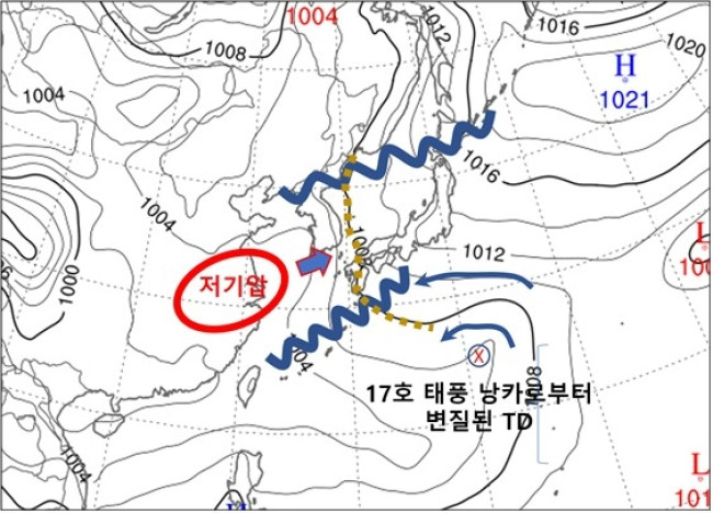 Atmospheric pressure system during the Geoje heavy rainfall. [Provided by KMA]
On the previous day alone, 654.3mm of rain fell in Geoje, marking the third-highest daily rainfall recorded in Korea since meteorological observations began across 97 automated synoptic observing stations. The only cases with higher daily rainfall than Geoje's were in August 2002, when Typhoon Rusa made landfall, dumping 870.5mm and 712.5mm of rain in one day in Gangneung and Daegwallyeong, Gangwon Province, respectively.
Geoje also experienced an "extreme downpour" in which 124.5mm of rain fell in just one hour during the early morning of the previous day.
Furthermore, a total of 928.0mm of rain fell in Geoje between Liberation Day on the 15th and midnight on the 18th, meaning an entire season's worth of summer rainfall poured down in just three days.

 [Statement by the Seo-beo-kka Korea Military Academy Patriotic Comrades Association] ㊷ We Condemn the Ruling Party Leader's Intimidation and Mockery of Supreme Court Justices, and Acts of Destroying the Judiciary
Chief Justice of the Supreme Court Cho Hee-de (left) and Democratic Party of Korea Leader Lee Jae-myung [Photo=Yonhap News]We are witnessing an unprecedented situation where the newly inaugurated lead
[Statement by the Seo-beo-kka Korea Military Academy Patriotic Comrades Association] ㊷ We Condemn the Ruling Party Leader's Intimidation and Mockery of Supreme Court Justices, and Acts of Destroying the Judiciary
Chief Justice of the Supreme Court Cho Hee-de (left) and Democratic Party of Korea Leader Lee Jae-myung [Photo=Yonhap News]We are witnessing an unprecedented situation where the newly inaugurated lead
 Criticizing Trump, yet… Europe also backsliding on climate change response
Greenpeace, an environmental organization calling for renewable energy policies [EPA=Yonhap News file photo]European nations, which previously criticized U.S. President Donald Trump's rollback of clim
Criticizing Trump, yet… Europe also backsliding on climate change response
Greenpeace, an environmental organization calling for renewable energy policies [EPA=Yonhap News file photo]European nations, which previously criticized U.S. President Donald Trump's rollback of clim
 PPP on Nomination of 'Ruling Party-Recommended' Special Inspector Candidate: "We Will Rigorously Verify Them at the Hearing"
People Power Party representative Jang Dong-hyeok is speaking at the Supreme Council meeting held at the National Assembly on the 24th. [Yonhap News] On the 24th, the People Power Party stated th
PPP on Nomination of 'Ruling Party-Recommended' Special Inspector Candidate: "We Will Rigorously Verify Them at the Hearing"
People Power Party representative Jang Dong-hyeok is speaking at the Supreme Council meeting held at the National Assembly on the 24th. [Yonhap News] On the 24th, the People Power Party stated th
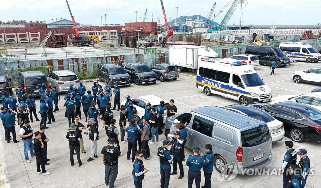 [Comprehensive] Another body of a missing person discovered in Jeju… 4th in three days
Police conducting an intensive search for missing persons [Yonhap News file photo]Recently, bodies suspected to be those of missing persons have been discovered in succession on Jeju Island. This mark
[Comprehensive] Another body of a missing person discovered in Jeju… 4th in three days
Police conducting an intensive search for missing persons [Yonhap News file photo]Recently, bodies suspected to be those of missing persons have been discovered in succession on Jeju Island. This mark
 [Korea-US Data Lab] 3rd Week of August (18th–21st) Money Insight
In the U.S., rising long-term Treasury yields lowered the future cash value of tech stocks, while in Korea, shareholder returns from Samsung Electronics and SK Hynix drove a rebound in major semicondu
[Korea-US Data Lab] 3rd Week of August (18th–21st) Money Insight
In the U.S., rising long-term Treasury yields lowered the future cash value of tech stocks, while in Korea, shareholder returns from Samsung Electronics and SK Hynix drove a rebound in major semicondu
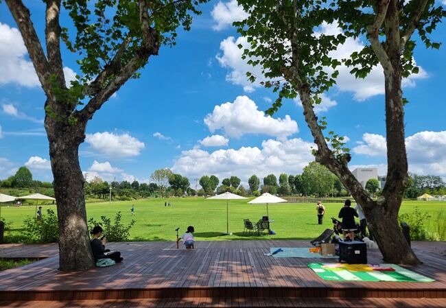 [Trending Travel Destinations] Unlocking a Century of Secrets: ‘Yongsan Children’s Garden’
Family visitors resting in the shade on a picnic mat. [Photo by Reporter Yohi Lim]Throughout history, the wealthy in both the East and the West have enjoyed greenery by creating private gardens on vas
[Trending Travel Destinations] Unlocking a Century of Secrets: ‘Yongsan Children’s Garden’
Family visitors resting in the shade on a picnic mat. [Photo by Reporter Yohi Lim]Throughout history, the wealthy in both the East and the West have enjoyed greenery by creating private gardens on vas
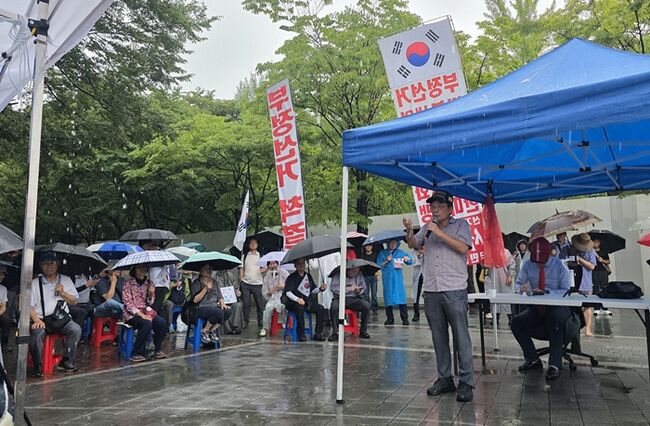 [Photo] Btooyun “We are recruiting 1,600 members for the Olympic Park Scientific Verification Team”… The rainy scenery of Olympic Park on the 22nd
On Saturday the 22nd, amid rainy weather at Olympic Park, the National Coalition for Election Fraud Struggle held a public forum on election integrity. They argued that the "Olympic Park Scientific Ve
[Photo] Btooyun “We are recruiting 1,600 members for the Olympic Park Scientific Verification Team”… The rainy scenery of Olympic Park on the 22nd
On Saturday the 22nd, amid rainy weather at Olympic Park, the National Coalition for Election Fraud Struggle held a public forum on election integrity. They argued that the "Olympic Park Scientific Ve
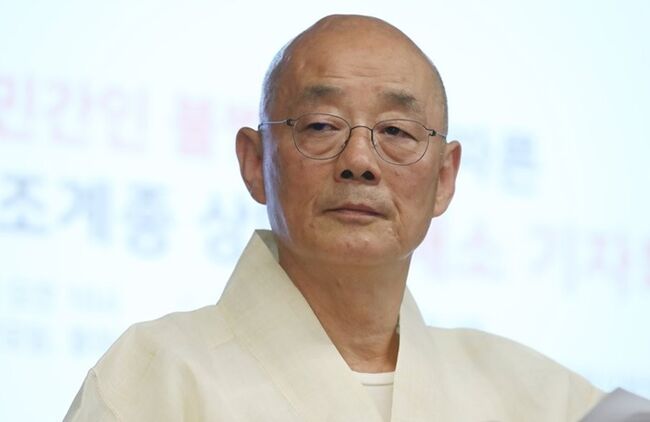 [Special Contribution: Songsan] The Life of a Political Monk Must Also Be Evaluated… What the Passing of Venerable Myeongjin Leaves Behind
Venerable Myeongjin, former head monk of Bongeunsa Temple, passed away on the 22nd. He was 76 years old and had been a monk for 52 years. [Yonhap News File Photo]Various narratives are emerging follow
[Special Contribution: Songsan] The Life of a Political Monk Must Also Be Evaluated… What the Passing of Venerable Myeongjin Leaves Behind
Venerable Myeongjin, former head monk of Bongeunsa Temple, passed away on the 22nd. He was 76 years old and had been a monk for 52 years. [Yonhap News File Photo]Various narratives are emerging follow
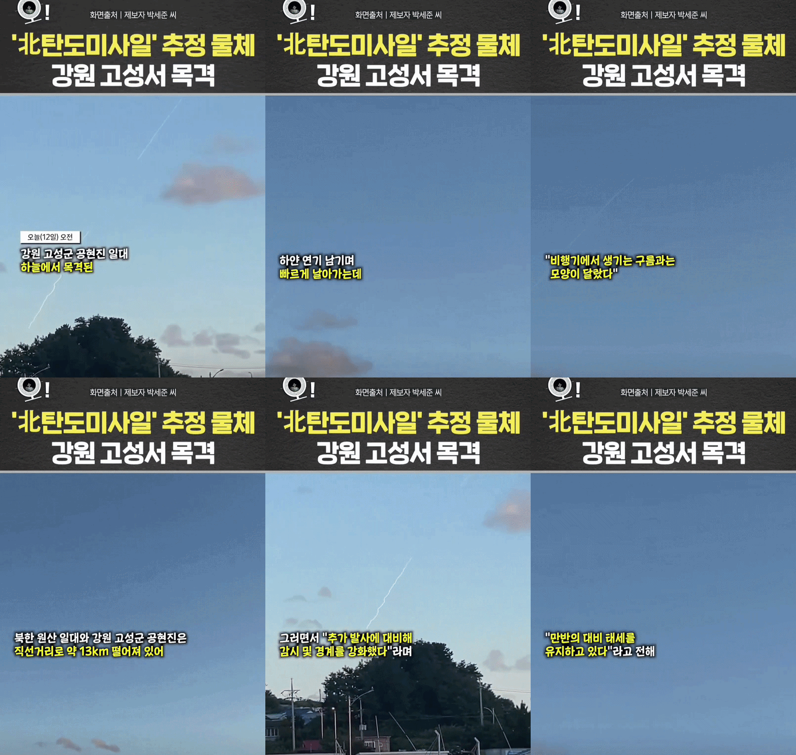 [Video] North Korean ballistic missile filmed by a civilian in Goseong, Gangwon-do
 [Editorial Cartoon] A Draconian Law That Undermines Freedom of Expression

 List
List